
The first-ever human trip to the vicinity of the lunar South Pole during Artemis III is well underway. To be ready, NASA scientists and engineers are studying as much as they can about this mysterious region that holds the potential to provide scientific discoveries that will advance human space exploration and our understanding of our role in the universe.
Researchers are using the ShadowCam hypersensitive optical camera as one method of information collecting.
The permanently shadowed wall and floor of Shackleton crater, located close to the South Pole, are depicted in one of ShadowCam’s initial images from lunar orbit, shown here in greater detail than ever before. ShadowCam’s ability to operate in highly dim lighting makes this image’s degree of detail possible.
The arrow indicates the boulder’s path down the crater wall. To better understand the geotechnical characteristics of the Moon, scientists characterize the boulder shape, velocity, and regolith features by observing these trails.
The image it captured was taken under Earthshine in the Moon’s equatorial region as part of an instrument sensitivity test. It reveals the interior of Bruce’s Crater and bright streamers formed from soil sliding down the crater’s walls.
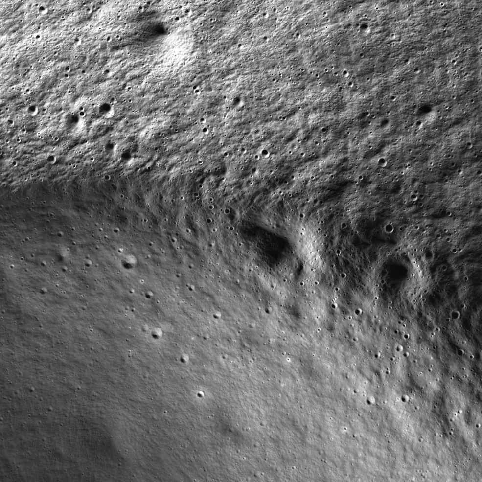
The rim of the Marvin crater can be seen in the image above, which was taken with the latter type of light, and is located around 16 miles (26 kilometers) from the South Pole. Because the secondary illumination comes from a broad arc rather than a point light source, there is a variation of more than 90 degrees in the lighting direction between the small craters on the rim and those in the small interior craters.
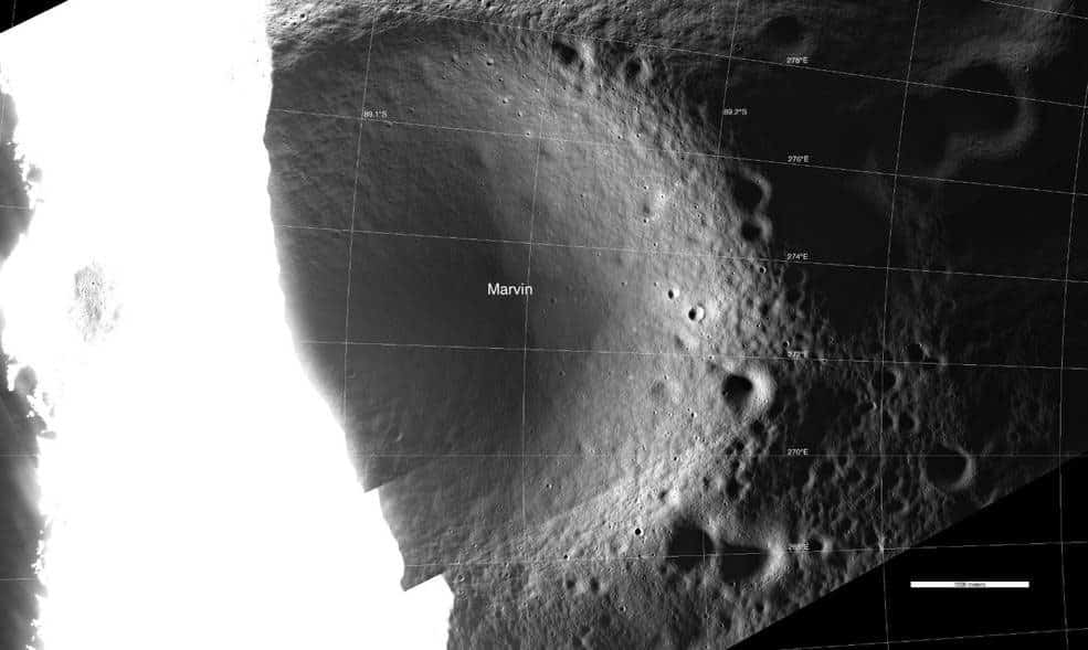
A broader region surrounding the Marvin crater can be seen in the image. The secondary illumination source inside the shadowed regions is the white area on the left, where the surface was exposed to direct sunshine. Because ShadowCam was made to work in low light, the areas that receive sunlight are saturated.
Although ShadowCam was primarily designed to use secondary illumination from lunar geologic features for imaging, this image was captured using Earthshine, showing the Aristarchus crater central peak (left).
This image, however, shows that it may be possible using Earthshine if astronauts are spacewalking during the lunar night.
In this image, the shadow cast by the Aristarchus central peak is from the Earthshine that resulted from the Earth being 35 degrees above the horizon at the time. The different tones in the central peak are thought to represent distinct rock types.