
Tropical Cyclone Fani, the strongest tropical cyclone to hit India in 20 years, made landfall on Friday, May 3. Fani, an equivalent of a Category 4 hurricane — packing sustained winds of 240 kilometers per hour (150 miles per hour).
Recently, NASA’s GPM or Global Precipitation Measurement mission satellite provides data, revealing heavy rainfall, before it made landfall in northeastern India. The satellite provided information on precipitation from its orbit in space.
It was raining at a rate of about 1.6 inches (40 mm) per hour. Rainfall was occurring at a rate around 1 inch (25 mm) per hour in bands of thunderstorms circling the center.
On May 1 at 7:56 a.m. EDT (1156 UTC), the GPM Core Observatory captured an overpass of the powerful storm as it continued strengthening and moving toward landfall. A 3-D image and a color-enhanced rainfall image were created at NASA‘s Goddard Space Flight Center in Greenbelt, Maryland.
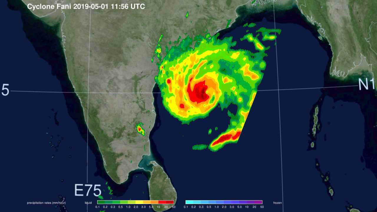
The images showed how high thunderstorms stretched into the troposphere and measured rainfall rates. GPM found that some of the heaviest rainfall rates were up to 50 millimeters (2 inches) per hour and were in the western quadrant of the storm.