
A new small satellite with a size of a cereal box has captured an inside look at Hurricane Florence in a trial of technology that could impact the future of storm monitoring from space. The satellite took its first pictures of Hurricane Florence on Tuesday, Sept. 11, only hours after its instrument was turned on.
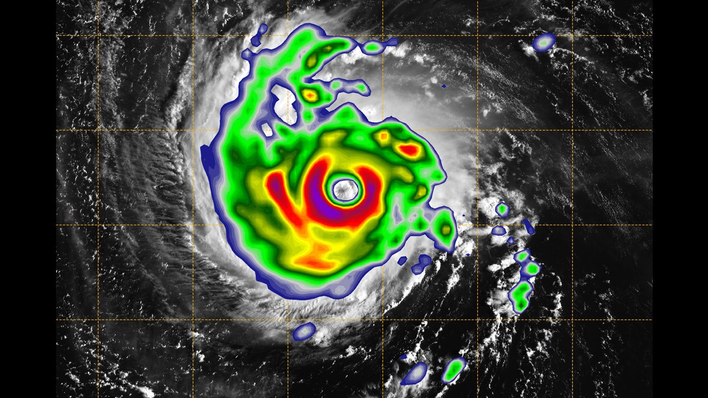
The satellite named TEMPEST-D carries a state-of-the-art miniaturized microwave radiometer, an instrument that sees through the thick clouds to reveal the hidden interior of storms. It has captured Florence over the Atlantic Ocean, revealing the eye of the storm surrounded by towering, intense rain bands.
The green zones feature the degree of the rain being produced by the storm, with the most intense rain appeared in yellow and red. The TEMPEST-D data has appeared differently in relation to a noticeable picture of Florence that demonstrates the commonplace cyclone-shaped clouds of the storm, however.
TEMPEST-D‘s mission is to test new, low-cost technology that could be used in the future to gather more weather data and help researchers better understand storms. The level of detail in the small-satellite image is similar to what existing weather satellites produce.
Sharmila Padmanabhan, who led the instrument development at NASA‘s Jet Propulsion Laboratory in Pasadena, California said, “We were challenged to fit this instrument into such a small satellite without compromising data quality and were delighted to see it work right out of the box.”
Steven Reising, the principal investigator for TEMPEST-D at Colorado State University said, “TEMPEST-D paves the way for future missions where we can afford to fly many of these miniaturized weather satellites in constellations. Such a deployment would enable us to watch storms as they grow.”