
NASA’s Curiosity rover, as part of NASA’s Mars Science Laboratory mission (MSL), was launched from Cape Canaveral on November 26, 2011, at 15:02 UTC and landed on Aeolis Palus inside Gale on Mars on August 6, 2012, 05:17 UTC. As established by the Mars Exploration Program, the main scientific goals of the MSL mission are to help determine whether Mars could ever have supported life, as well as assessing the role of water, and to study the climate and geology of Mars.
What’s more, the meanderer is a long way from done, having recently bored its 22nd sample from the Martian surface. It has a few more years before its nuclear power system degrades enough to limit operations significantly. From that point onward, careful budgeting of its power will enable the rover to continue studying the Red Planet.
The rover is now investigating one of the most exciting regions so far on its seven-year journey. Scientists call the area the ‘clay-bearing unit‘ on the side of Mount Sharp, inside of Gale Crater. After drilling two new samples, the rover affirmed high amounts of clay minerals, providing further proof that ancient Mars was once much wetter.
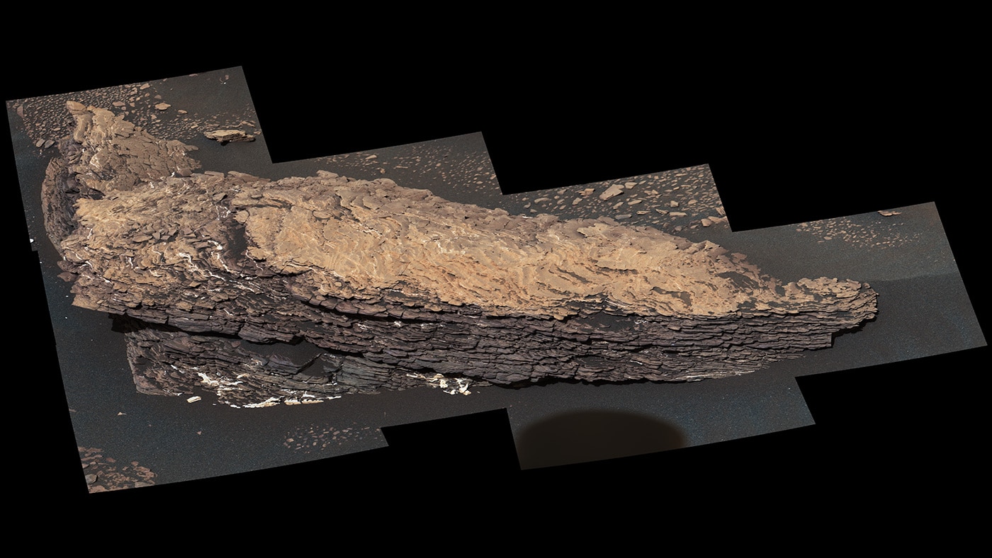
This mosaic of images shows a boulder-sized rock called “Strathdon,” which is made up of many complex layers. NASA’s Curiosity Mars rover took these images using its Mast Camera, or Mastcam, on July 9, 2019, the 2,461st Martian sol, or day, of the mission.
Credits: NASA/JPL-Caltech/MSSS
Rock samples that the rover has drilled here have revealed the highest amounts of clay minerals found during the mission. But Curiosity has detected similarly high amounts of clay on other parts of Mount Sharp, including in areas where MRO didn’t detect clay. That’s led scientists to wonder what is causing the findings from orbit and the surface to differ.
The campaign’s other co-lead, Valerie Fox of Caltech said, “The science team is thinking through possible reasons as to why the clay minerals here stood out to MRO. The rover encountered a ‘parking lot full of gravel and pebbles’ when it first entered the area.”
“One idea is that the pebbles are the key: Although the individual pebbles are too small for MRO to see, they may collectively appear to the orbiter as a single clay signal scattered across the area. Dust also settles more readily over flat rocks than it does over the pebbles; that same dust can obscure the signals seen from space. The pebbles were too small for Curiosity to drill into, so the science team is looking for other clues to solve this puzzle.”
Credits: NASA/JPL-Caltech/MSSS
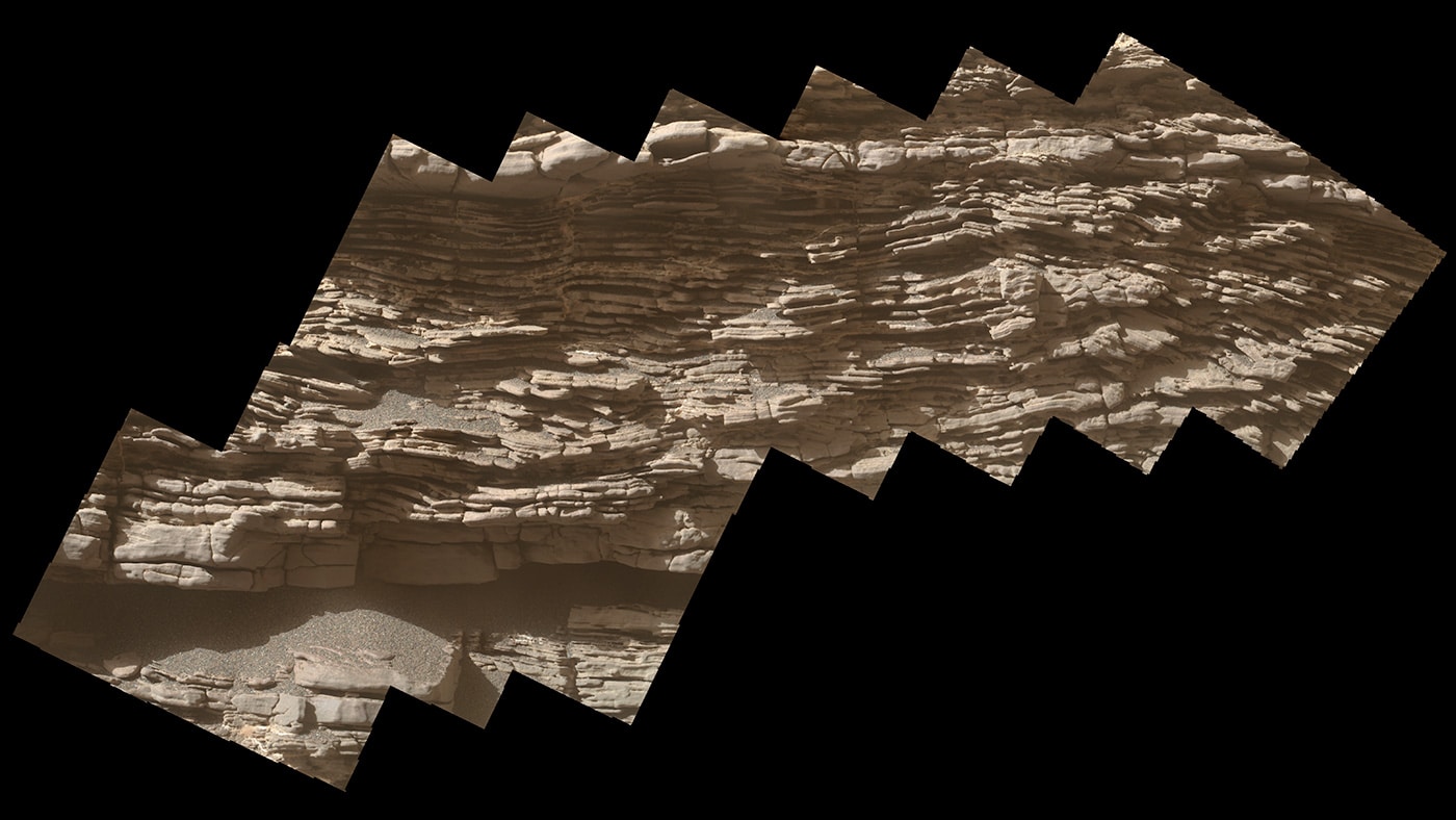
“Curiosity exited the pebble parking lot back in June and started to encounter more complex geologic features. It stopped to take a 360-degree panorama at an outcrop called “Teal Ridge.” More recently, it took detailed images of “Strathdon,” a rock made of dozens of sediment layers that have hardened into a brittle, wavy heap. Unlike the thin, flat layers associated with lake sediments Curiosity has studied, the wavy layers in these features suggest a more dynamic environment. Wind, flowing water or both could have shaped this area.”
“Both Teal Ridge and Strathdon represent changes in the landscape. We see an evolution in the ancient lake environment recorded in these rocks. It wasn’t just a static lake. It’s helping us move from a simplistic view of Mars going from wet to dry. Instead of a linear process, the history of water was more complicated.”
Curiosity is finding a richer, progressively complex story behind the water on Mount Sharp.