NASA’s Terra satellite offers visible imagery suggesting that northerly wind shear is largely affecting Tropical Cyclone Haleh and consistently weakening the storm.
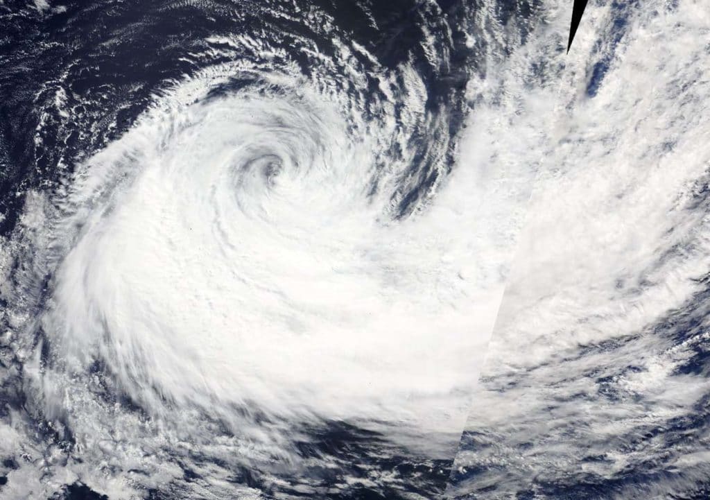
The image showed the northeastern quadrant surrounded by wispy clouds, while the bulk of clouds and showers were pushed south and southwest of the center of circulation. Haleh also had a thick band of thunderstorms wrapping into the southern quadrant from the southeast.
On March 9 the Moderate Resolution Imaging Spectroradiometer or MODIS instrument aboard NASA‘s Terra satellite provided a visible image of Haleh in the Southern Indian Ocean. At 10 a.m. EST (1500 UTC) the Joint Typhoon Warning Center or JTWC reported the drop in Haleh’s maximum sustained winds by 40 knots (46 mph/74 kph).
It was centered near 32.9 degrees south latitude and 65.5 degrees east longitude. That’s 852 nautical miles south-southeast of Port Louis, Mauritius. Haleh was moving north-northwest and is forecast to turn to the north-northeast.
The Joint Typhoon Warning Center or JTWC reported “animated multispectral satellite imagery depicts a 130 nautical-mile cirrus cloud [high clouds] shield [layer] with isolated deep convection [strong storms] that is obscuring the low-level circulation center. Low-level rain bands are visible beyond the cirrus shield in all quadrants.”