Have you ever wondered how astronauts navigate through the vast expanses of space? While they have access to GPS technology, it can be difficult to navigate uncharted territory on other planets without a map.
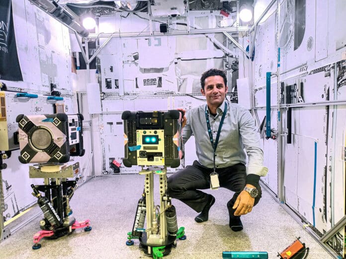
A new project sponsored by the International Space Station (ISS) National Laboratory is addressing this challenge with the Multi-Resolution Scanner (MRS). By using NASA’s free-flying robotic Astrobee system on the space station, the MRS will test an innovative 3D mapping technology that can produce detailed maps of remote environments.
This innovative project could revolutionize space exploration by providing space travelers with the tools they need to navigate and explore uncharted territory with greater ease and accuracy.
The MRS project is a collaboration between Boeing and CSIRO, an Australian government agency responsible for scientific research. CSIRO’s Parkes radio telescope, Murriyang, received television signals from the event watched by nearly 600 million viewers worldwide. The organization is now working on a project that will benefit future exploration missions as well as key industries on Earth.
The MRS project, which was part of the payload delivered by SpaceX’s 30th Commercial Resupply Services mission, aims to enhance our understanding of space environments. This technology is not just limited to the confines of the ISS; it has the potential to rapidly create 3D maps of various environments in unprecedented detail, like the space station or even a lava tube on the Moon or Mars.
“We will use NASA’s free-flying Astrobee robots to test MRS, which will allow us to create 3D maps of the space station’s Kibo module,” said Marc Elmouttie, a research group leader at CSIRO. “The technology we’re using combines multiple sensors, which compensates for weaknesses in any one of them and provides very high-resolution 3D data and more accurate trajectory data to understand how the robot moves around in space.”
Exploring space is a challenging task, and robotic explorers play a vital role in it. These explorers in space or on Mars rely on simultaneous localization and mapping (SLAM) to build detailed maps of their environment and navigate autonomously. To achieve this, they use onboard sensors and cutting-edge software like Stereo-Depth Fusion and 3D SLAM technology such as Wildcat by CSIRO.
Recently, a team led by Elmouttie validated the software by mapping a known location on the space station – the Kibo module. This mission was successfully launched on SpaceX’s 30th Commercial Resupply Services (CRS) mission and installed into one of the Astrobee robots after arriving at the station.
Starting with Kibo allows the team to check the resulting maps against controls to see how well the technology functions in microgravity. Previous ground-based experiments have shown that the software’s highly accurate mapping and positioning capabilities could enable robots like Astrobee to successfully navigate unsafe, complex, and unstructured environments without GPS or other external positioning information.
If this project is successful, MRS could expand to other modules on the space station, increasing its mapping capabilities. These results would help advance the technology to the point where it could be used for future spaceflight missions and exploration endeavors.
Although the ISS has been continuously inhabited for more than 20 years, future space stations may not all be crewed by humans. NASA’s planned lunar Gateway, and even other outposts in space, could be predominately crewed by robots. This technology would enable robotic helpers to keep systems going autonomously when humans aren’t present.
“Boeing is committed to providing improved capabilities and enhancing safety for trips to the Moon and beyond,” said Scott Copeland, director for ISS research integration at Boeing. “That requires the intersection of crew and robotic tasks, and the Multi-Resolution Scanning technology being demonstrated onboard our testbed in low Earth orbit will be a powerful tool to help us meet those goals.”
With its ability to map terrain and detect valuable resources, MRS could be installed on rovers or helicopters sent to explore other planets. Additionally, MRS could be used to identify potential damage to spacecraft or infrastructure caused by micrometeorites or other impacts, making it a valuable tool for robotic caretakers in locations that are not continuously crewed. The possibilities for this technology are not limited to space exploration, as industries such as mining and disaster relief could also benefit from MRS’s capabilities here on Earth.
