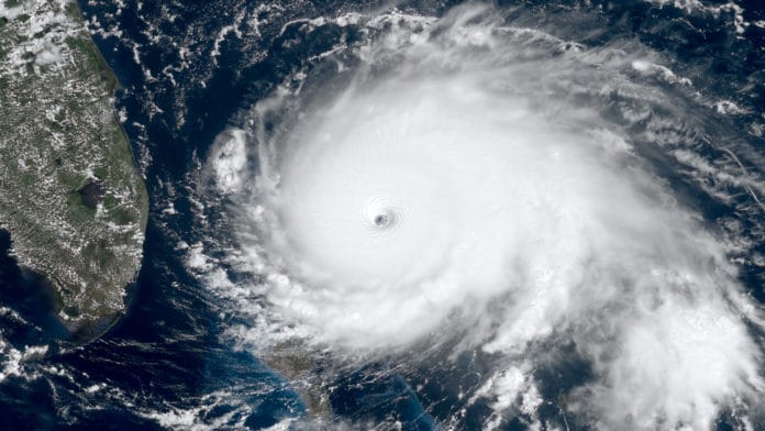
Instead of running after storms, NASA scientists are studying lighting to develop new methods to predict hurricane intensity.
During storms, powerful lightning strikes indicate the strength of strong. But, sometimes, even weak hurricanes can have large lightning outbreaks. That’s why forecasters must carefully look at other data to observe the role of the lightning outbreak in predicting hurricane’s intensity.
Using a new tool called the Geostationary Lightning Mapper (GLM) on the National Oceanic and Atmospheric Administration’s latest Geostationary Operational Environmental Satellites, scientists gathered information about lightning in hurricanes. In particular, they analyzed the two most distinct lightning outbreaks in the innermost part – or inner-core – of Hurricane Dorian.
They found that the lightning strikes in Hurricane Dorian were larger and more energetic when the storm was strengthening than weakening.
The tool works by continuously detecting the size and energy of lightning flashes, even over the open oceans. It has a sensor that acts as an optical event detector, detects changes in cloud-top radiance produced by lightning. The tool also can detect flash location, average flash area, and total optical energy. This property of this tool allows scientists to examine lightning from several new perspectives.
The first outbreak of Hurricane Dorian was occurred during intensification, including a period of rapid intensification (defined as an increase in 30 kts (35 mph) in sustained winds over 24 hours). During rapid intensification, the number of inner-core lightning flashes increased as flashes concentrated inside the maximum wind radius – or the distance between the center of the cyclone and its band of strongest winds.
The second outbreak occurred during weakening. As weakening continued, numerous flashes still occurred within the radius of maximum wind, with a flash rate more than three times that during rapid intensification – a signal typically associated with strengthening. These flashes, however, were much smaller and less energetic than those during intensification.
NASA researcher Patrick Duran said, “We also argue that changes in the location of lightning flashes could help to identify processes that affect a storm’s intensity. This information provides clues into how storm structure changes at peak intensity and can potentially help forecasters interpret whether a lightning outbreak signifies storm intensification or weakening.”
“In the future, we will analyze a large number of storms to discover how lightning patterns differ between storms that intensify and those that weaken. We think that these patterns could be especially useful in identifying rapid intensification, which is very difficult to predict.”
Stephanie Stevenson, meteorologist and programmer with the National Hurricane Center, said, “This study pushes us toward understanding how GLM’s unique area and energy fields can be used in conjunction with lightning density to monitor a storm’s evolution.”
Journal Reference:
- Patrick Duran et al. The Evolution of Lightning Flash Density, Flash Size, and Flash Energy During Hurricane Dorian’s (2019) Intensification and Weakening. DOI: 10.1029/2020GL092067
