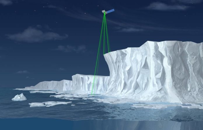
NASA’s Ice, Cloud and land Elevation Satellite-2 (ICESat-2), a mission to quantify the changing stature of Earth’s ice, is scheduled to launch Saturday, Sept. 15, with a 40-minute window opening at 8:46 a.m. EDT (5:46 a.m. PDT).
The shuttle will lift off from Space Launch Complex 2 at Vandenberg Air Force Base in California on the last launch of a United Launch Alliance Delta II rocket. The scope of prelaunch and launch activities will start by Thursday, Sept. 13.
ICESat-2 will carry a single instrument, the Advanced Topographic Laser Altimeter System (ATLAS), which will send 10,000 laser pulses a second to Earth’s surface and measure the height of ice sheets, glaciers, sea ice, and vegetation by calculating the time it takes the pulses to return to the spacecraft.
The precise and complete coverage afforded by ICESat-2 will enable researchers to track changes in land and sea ice with unparalleled detail, which will inform our understanding of what drives these changes.
NASA will host a prelaunch briefing at 4 p.m. Sept. 13 with:
- Tom Wagner, ICESat-2 program scientist at NASA Headquarters
- Doug McLennan, ICESat-2 project manager at NASA’s Goddard Space Flight Center
- Donya Douglas-Bradshaw, ATLAS instrument project manager at Goddard
- Tom Neumann, ICESat-2 deputy project scientist at Goddard
- Lori Magruder, ICESat-2 science definition team lead at the University of Texas at Austin
- Helen Fricker, ICESat-2 science definition team member at the Scripps Institution of Oceanography
- Bill Barnhart, ICESat-2 program manager at Northrop Grumman
- Tim Dunn, launch director at NASA’s Kennedy Space Center
- Scott Messer, program manager for NASA Programs at United Launch Alliance
- 1st Lt. Daniel Smith, launch weather officer with the 30th Space Wing at Vandenberg
