
On Wednesday, November 13, 2019, ISRO released images of an impact crater on the moon’s surface captured by Terrain Mapping Camera-2 (TMC-2).
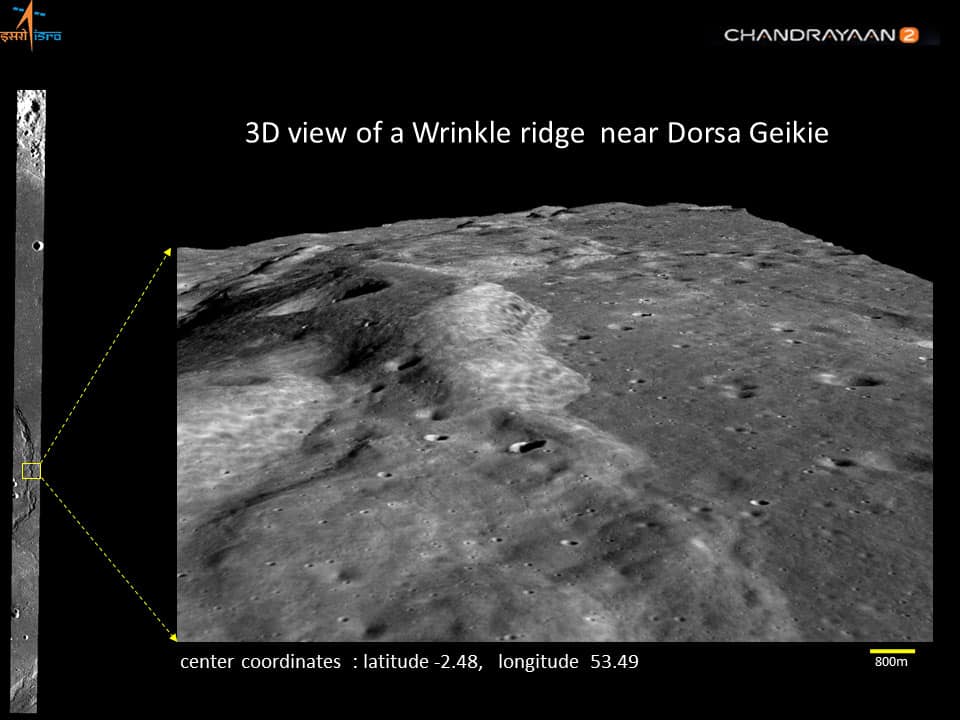
TMC-2 provides images at 5m spatial resolution & stereo triplets from a 100 km orbit for preparing the Digital Elevation Model (DEM) of the complete lunar surface. These images, when processed into Digital Elevation Models, enable mapping of surface landform morphologies, including craters, lava tubes, rilles, lunar domes, etc.
Take a look at these images.
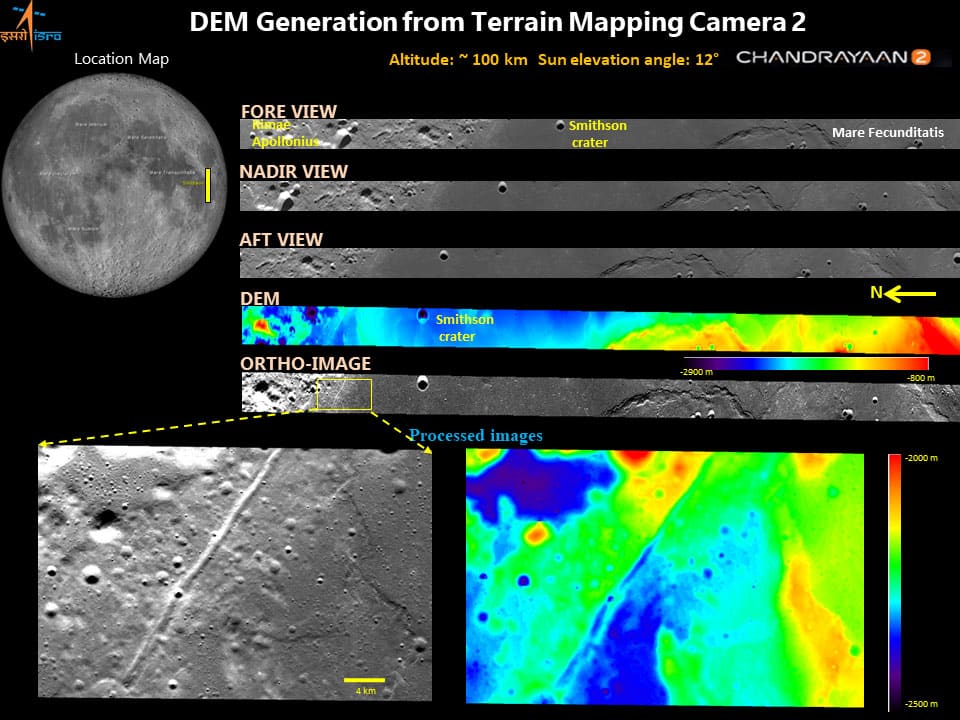
The derived data makes it easier to estimate the dimensions of the aforementioned features and compare them in order to reconstruct the morpho-structural framework, characterize craters to determine impact geometries, determine surface age using Crater Size-Frequency Distribution (CSFD) methods, perform rheological analysis using the derived morphometric parameters, estimate lunar reflectance, and more.