One of the most destructive natural hazards, tropical cyclone (TC)–induced coastal flooding, will worsen under climate change.
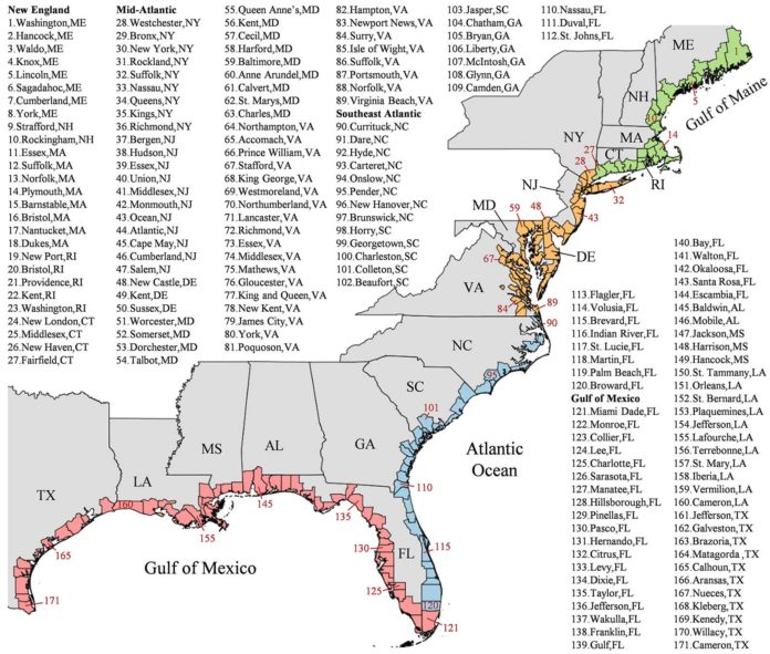
In a new study, by combining storm surge, sea-level rise and the predicted increased occurrence and strength in tropical storms and hurricanes, Princeton scientists created a map that predicts flood hazard possibility along the U.S. East Coast and the Gulf of Mexico.
The map predicts coastal flooding for every county on the Eastern and Gulf Coasts and finds 100-year floods could become annual occurrences in New England, and happen every one to 30 years along the southeast Atlantic and Gulf of Mexico shorelines.
Ning Lin, associate professor of civil and environmental engineering at Princeton, said, “The historical 100-year floods may change to one-year floods in northern coastal towns in the U.S.”
“For the Gulf of Mexico, we found the effect of storm change is compatible with or more significant than the effect of sea-level rise for 40% of counties. So, if we neglect the effects of storm climatology change, we would significantly underestimate the impact of climate change for these regions.”
Reza Marsooli, assistant professor of civil, environmental and ocean engineering at the Stevens Institute of Technology, said, “The study uses the latest climate science to examine how tropical storms will change in the future. The storm data, in turn, was integrated with sea-level analysis. The study combines multiple variables that are typically addressed separately. For example, the new maps use the latest climate science to look at how tropical storms will change in the future instead of what they are right now, or even looking backward at previous storms, as federal disaster officials do to build their flood maps. These data, in turn, are integrated with sea-level analysis.”
The study is published in the Journal Nature Communications.
