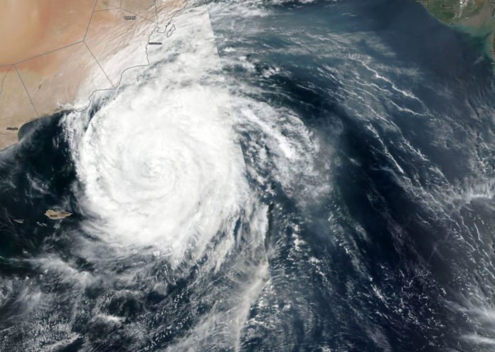
On Oct 11, NASA-NOAA’s Suomi NPP satellite, while passing over the Northern Indian Ocean captured that Tropical Cyclone Luban continued to track toward Oman.
The satellite uses the instrument called Visible Infrared Imaging Radiometer Suite (VIIRS) to capture a visible image of the storm. The VIIRS image showed Luban stretched from the Gulf of Marisa south to Socotra Island. Luban had a symmetrical shape with a cloud-filled eye, surrounded by powerful thunderstorms.
Tropical Cyclone Luban has strengthened in the Arabian Sea to the equivalent of a category 1hurricane. is expected to weaken to a tropical storm again this weekend when it makes its closest approach to Oman and Yemen. Heavy rain could bring a dangerous flood threat to parts of those countries.
According to the U.S. Joint Typhoon Warning Center (JTWC), Luban had sustained winds of 65 knots (75 miles/120 kilometers per hour) around midday on October 11. Maximum wave heights were estimated at 26 feet (8 meters). The storm was centered about 250 miles (400 kilometers) southeast of Salah, Oman, and moving westward at just 2 knots (2.3 miles per hour).
