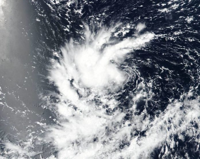
On Aug. 14, NASA-NOAA’s Suomi NPP satellite flew over developing Pacific Tropical Depression 14E in the Eastern Pacific Ocean. The satellite discovered thunderstorms wrapping into the center from the north.
On Aug. 15 at 5 a.m. EDT (0900 UTC), the National Hurricane Center (NHC) announced the focal point of Tropical Depression Fourteen-E was situated near latitude 10.8 degrees North and longitude 122.3 degrees west. That is around 1,170 miles (1,880 km) southwest of the southern tip of Baja California, Mexico.
The depression is pushing toward the west near to 14 mph (22 kph), and this general movement over the open Pacific Ocean is relied upon to proceed for the following couple of days. A swing toward the west-northwest is a figure to happen on Friday.
Maximum sustained winds remain near 35 mph (55 kph) with higher gusts. Gradual strengthening is forecast during the next three days, and the depression is expected to become a tropical storm later today and a hurricane by late Thursday or Friday.
