
Using instruments like Terra and Aqua satellites, NASA is consistently watching Hurricane Lane, a category 2 storm as of Friday, Aug. 24 — made its way toward Hawaii.
On Aug. 24, NASA’s Multi-angle Imaging SpectroRadiometer (MISR) captured images of Lane. MISR, flying onboard NASA’s Terra satellite, conveys nine cameras that watch Earth at various edges. It takes roughly seven minutes for each of the cameras to watch a similar area, and the movement of the clouds amid that time is utilized to compute the wind speed at the cloudtops.
The image captured by MISR shows the storm, a stereo anaglyph, which combines two of the MISR angles to show a three-dimensional view of Lane. It requires red-blue glasses to view the anaglyph. In this image, the north view is captured at the bottom.
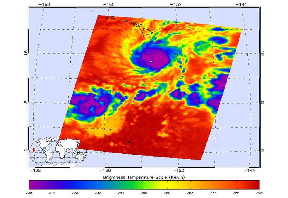
The infrared imagery represents the temperatures of cloud tops and the ocean surface. Purple shows very cold clouds high in the atmosphere above the center of the hurricane, while blue and green show the warmer temperatures of lower clouds surrounding the storm center. The orange and red areas, away from the storm, have almost no clouds, and the ocean shines through.
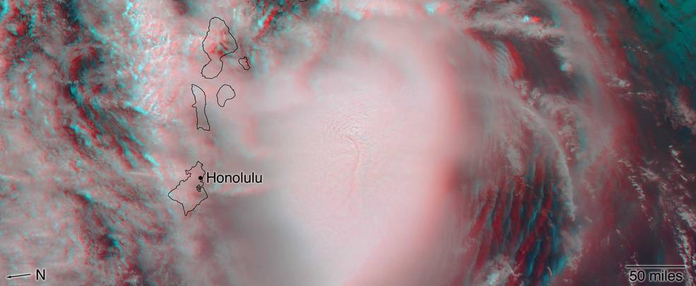
Credits: NASA/GSFC/LaRC/JPL-Caltech, MISR Team
AIRS, in conjunction with the Advanced Microwave Sounding Unit (AMSU), senses emitted infrared and microwave radiation from Earth to provide a three-dimensional look at Earth’s weather and climate. Working in tandem, the two instruments make simultaneous observations all the way down to Earth’s surface, even in the presence of heavy clouds.
With more than 2,000 channels sensing different regions of the atmosphere, the system creates a global, three-dimensional map of atmospheric temperature and humidity, cloud amounts and heights, greenhouse gas concentrations, and many other atmospheric phenomena. Launched into Earth orbit in 2002, the AIRS and AMSU instruments fly onboard NASA’s Aqua spacecraft and are managed by JPL.