
Hurricane Michael was the strongest tropical cyclone to strike the United States since Andrew in 1992 and the strongest on record in the Florida Panhandle. It was the third-most intense hurricane to make landfall.
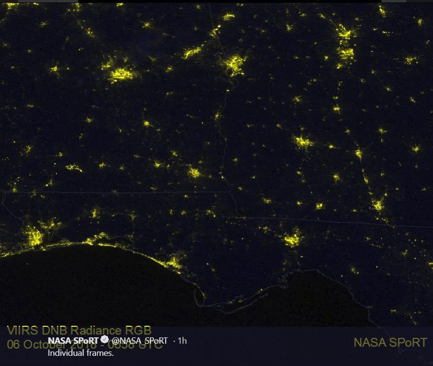
On Oct. 12 at 2:45 a.m. EDT (0645 UTC) the VIIRS instrument aboard NOAA’s NOAA-20 satellite captured a view of the change in night-time lights in the area of the Florida Panhandle and Georgia where Hurricane Michael traveled, knocking out power. The right image was taken after Michael made land (taken on October 12) is compared to an image taken Oct. 6 at 2:58 a.m. EDT (0658 UTC) to show the difference.
Recently, NASA satellite imagery showed that although Michael’s center was off-shore of the Delmarva Peninsula and over the western Atlantic Ocean, rain from its western quadrant was affecting the northeastern U.S.
The post-tropical cyclone is moving toward the east-northeast near 29 mph (46 kph), and this motion is expected to continue with an increase in forwarding speed during the next couple of days. On the forecast track, the center of Michael will move away from the United States today and move rapidly across the open Atlantic Ocean tonight through Sunday.