
To summarize the current state of lunar geologic knowledge, the US Geologic Survey has created one of the most detailed maps of the Moon. This 1:5,000,000-scale geologic map combines six lunar geologic maps (near, central far, east, west, north, and south sides).
The map includes the basemap data, GIS layers, grids, and the brief description of the map unit and explanation of map symbols.
According to USGS, the map will serve as a blueprint that can help navigate and guide future missions to the Moon.
Corey Fortezzo, USGS geologist and lead author, said, “This map is a culmination of a decades-long project. It provides vital information for new scientific studies by connecting the exploration of specific sites on the Moon with the rest of the lunar surface.”
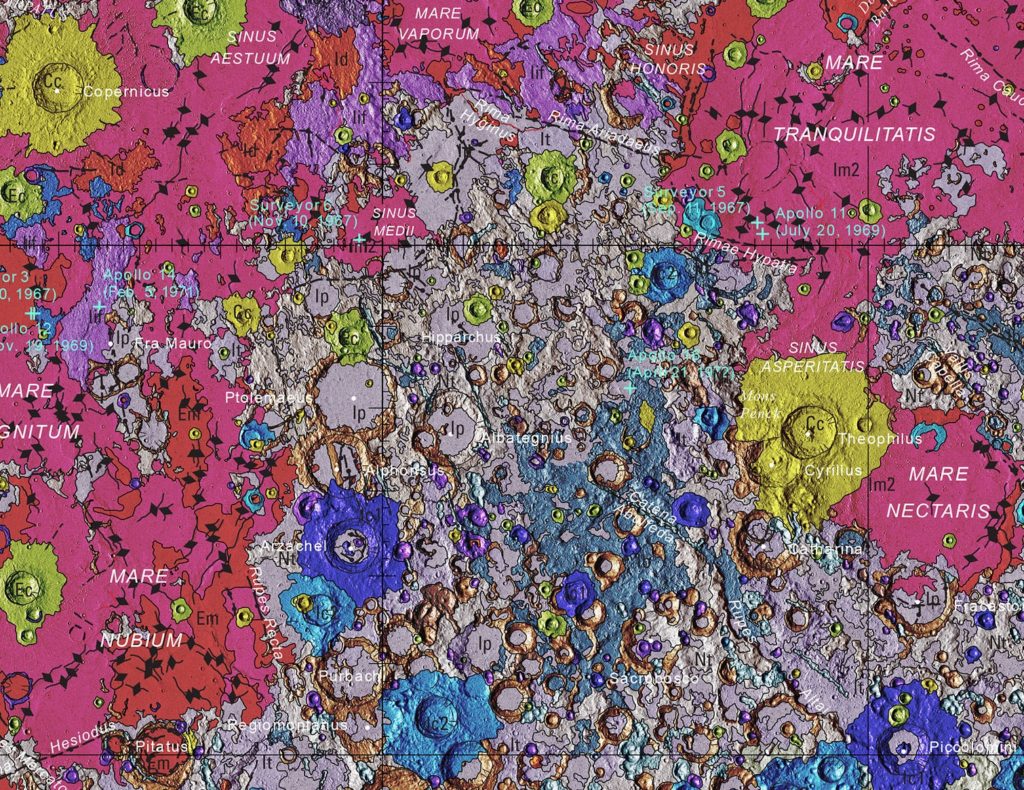
The near side of the Moon can be seen full of pinks that show the Imbrian era formation, taking place about 3.5 billion years ago. The Moon’s surface was hit by many asteroids during this period.
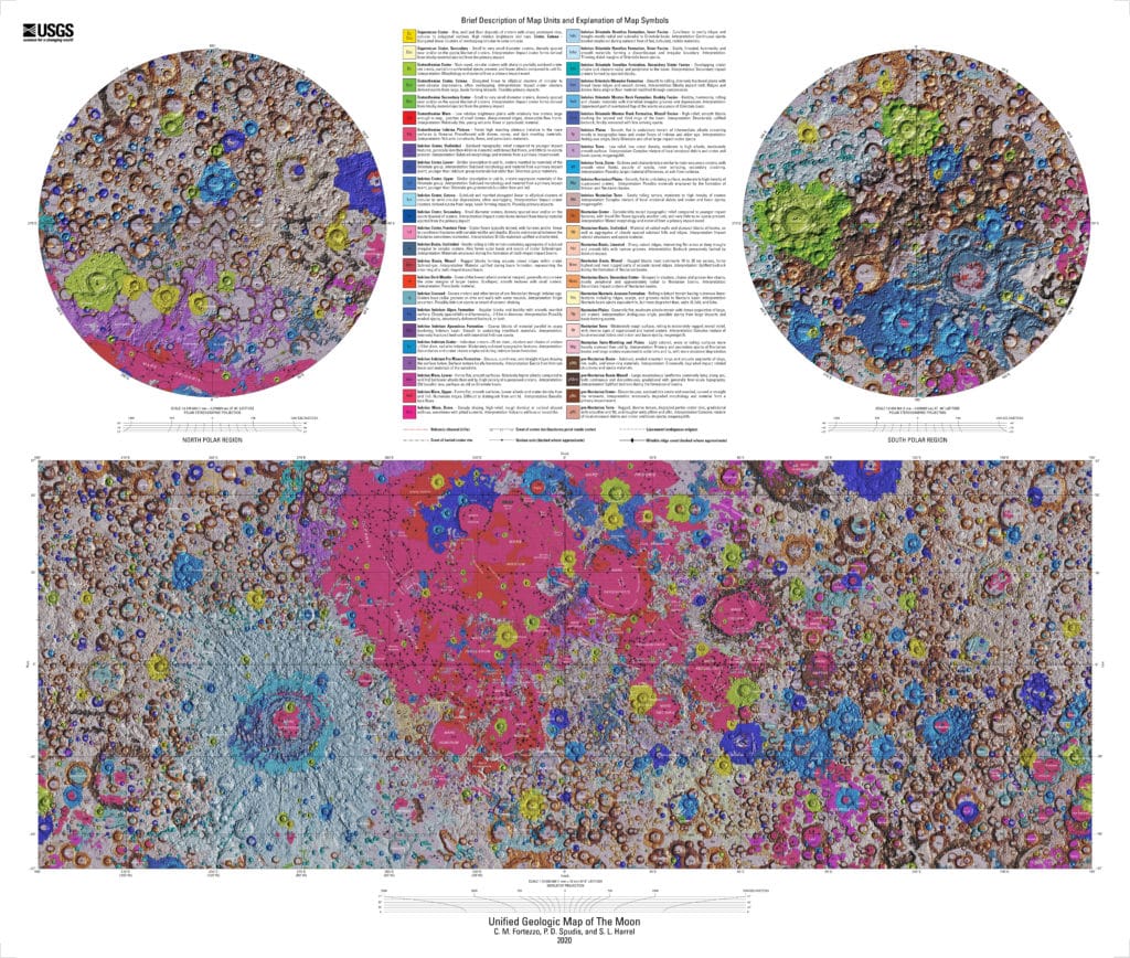
The topographical measurements were taken by the US’ Lunar Orbiter Laser Altimeter and by Japan’s SELENE Kaguya terrain camera stereo.
Understanding the surface of the Moon allows geologists to learn more about the early history of our solar system. The chemical composition of these rocks and craters also helps scientists see the Earth’s early chemical composition.
Journal Reference:
- RELEASE OF THE DIGITAL UNIFIED GLOBAL GEOLOGIC MAP OF THE MOON AT 1:5,000,000- scale. https://www.hou.usra.edu/meetings/lpsc2020/pdf/2760.pdf
- Unified_Geologic_Map_of_the_Moon_RASTER.zip