
Using advanced ground-penetrating radar (GPR), archeologists have succeeded in mapping an entire Roman city, Falerii Novi, in Italy. The discovery allowed archeologists to reveal astonishing details while it remains buried underground.
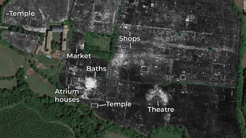
A team of scientists, including from the University of Cambridge and Ghent University, has discovered a bath complex, market, temple, a public monument unlike anything seen previously, and even the city’s sprawling network of water pipes. By taking a gander at various profundities, the archeologists would now be able to concentrate on how the town evolved for more than several years.
The investigation harness ongoing advances in GPR technology, which makes it conceivable to investigate larger territories with higher goals than ever before. This is probably going to have significant ramifications for the investigation of ancient cities because many can’t be uncovered either. After all, they are excessively large or because they are caught under modern structures.
By towing their GPR instruments behind a quad bike, the archeologists surveyed all 30.5 hectares within the city’s walls—Falerii Novi was just under half the size of Pompeii—taking a reading every 12.5cm.
Located 50 km north of Rome and first occupied in 241 BC, Falerii Novi survived into the medieval period (until around AD 700). The team’s GPR data can now start to reveal some of the physical changes experienced by the city at this time. They have already found evidence of stone robbing.
The study also challenges certain assumptions about Roman urban design, showing that Falerii Novi’s layout was less standardized than many other well-studied towns, like Pompeii. The temple, market building, and bath complex discovered by the team are also more architecturally elaborate than would usually be expected in a small city.
In a southern district, just inside the city’s walls, GPR revealed a substantial rectangular building connected to a progression of water pipes, which led to the aqueduct. Astoundingly, these funnels can be followed across a lot of Falerii Novi, running underneath its insulae (city squares), and not merely along its lanes, as might regularly be expected. The group expected that this structure was an outdoor natatio or pool, forming part of a substantial public bathing complex.
Near the city’s north gate, archeologists found a pair of large structures facing each other within a porticus duplex. They believe these were part of an impressive public monument and contributed to an intriguing sacred landscape on the city’s edge.
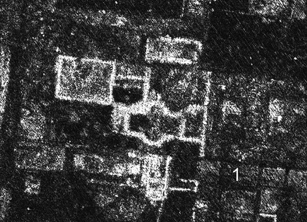
GPR time-slice in the case study area, at an estimated depth of 0.75–0.80m. (1) marks the removal of walls by stone robbing. Credit: L. Verdonck 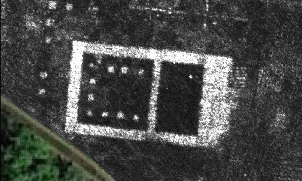
GPR map of Falerii Novi’s temple. Crdit: L. Verdonck 
The porticus duplex and public monument to the east of Falerii Novi’s north gate, shown on a GPR time-slice, at an estimated depth of 0.80–0.85m. The white dots mark the central row of columns of the covered passageway approximately 90 × 40m. Within, a pair of structures facing each other (each with a central niche) acted as a public monument. Credit: L. Verdonck
Corresponding author, Professor Martin Millett from the University of Cambridge’s Faculty of Classics, said:
“The astonishing level of detail which we have achieved at Falerii Novi, and the surprising features that GPR has revealed, suggest that this type of survey could transform the way archeologists investigate urban sites as total entities.”
“It is exciting and now realistic to imagine GPR being used to survey a major city such as Miletus in Turkey, Nicopolis in Greece, or Cyrene in Libya. We still have so much to learn about Roman urban life, and this technology should open up unprecedented opportunities for decades.”
Journal Reference:
- L. Verdonck et al., Ground-penetrating radar survey at Falerii Novi: a new approach to the study of Roman cities. DOI: 10.15184/aqy.2020.82